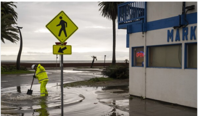
As California braces for an imminent megastorm, meteorologists from the National Weather Service Los Angeles office issue a stark warning, raising concerns about severe and widespread flash flooding. The aftermath of a frontal band has left an unstable air mass, paving the way for isolated thunderstorms and heavy rainfall, particularly in Southern California. With a focus on the weekend and early next week, the threat looms large, prompting urgent calls for preparation, potential evacuations, and heightened vigilance among residents.
Current Conditions and Short-Term Outlook
Presently, the remnants of the frontal band have moved eastward, leaving behind a moderately unstable air mass capable of producing scattered showers and isolated thunderstorms with brief, intense periods of rainfall. The threat zone, as highlighted by the National Weather Service, extends from the mountains to southern Los Angeles County, San Luis Obispo, and northern Santa Barbara Counties. While Friday and Saturday are expected to be relatively dry for most regions, scattered light showers are anticipated in mountainous areas and north of Point Conception.
Gusty westerly winds up to 40 mph are forecasted along the coast south of Point Conception. Additionally, coastal and valley areas are expected to experience cooler overnight temperatures ranging from the 30s to 40s.
Looking ahead, weather models suggest the onset of rain as early as late Saturday, primarily in the form of warm frontal rain. However, the presence of an atmospheric river and strong low-level forcing from south-facing mountains could result in substantial rainfall. The risk of the system stalling south of Point Conception raises concerns about an extended period of intense rain from late Saturday night through Sunday and Monday.

Rainfall rates are projected to reach up to half an inch per hour, particularly in south-facing mountains. Given the already saturated ground from previous rainfall, the potential for dangerous flash flooding is significantly heightened. Residents, especially those in or near south-facing mountains, are strongly advised to prepare for potential evacuations during or even before the storm makes landfall.
Rainfall Predictions and Potential Impact
Rainfall predictions paint a worrisome picture, with estimates ranging from 3-6 inches for coast and valleys, 6-12 inches in the mountains, and the potential for higher amounts, especially south of Point Conception. Alarmingly, there is a 30-50% chance that some south-facing mountain areas could bear the brunt of up to 15 inches of rain. Coastal and valley areas might see 6-10 inches as a storm total through Monday evening.
This megastorm has the potential to unleash unprecedented amounts of rain across a widespread area, presenting a very dangerous situation for residents and communities. Authorities are urging immediate and comprehensive precautionary measures. Snow levels are anticipated to be around 7000 feet during the heaviest rainfall, with substantial snowfall impacting areas near the Kern County line and the eastern San Gabriels.
Given the imminent threat of severe flooding, authorities are issuing urgent calls to action for residents. Immediate precautions include staying informed through official channels, preparing emergency kits, and heeding evacuation orders if and when issued. The potential impact on transportation, infrastructure, and communities is significant, requiring a collective and coordinated effort to mitigate the risks associated with this impending megastorm.
Community Preparedness and Resilience
As California faces this unprecedented threat, the importance of community preparedness and resilience cannot be overstated. Local authorities are actively disseminating information to keep residents informed about evacuation routes, emergency shelters, and critical updates. The cooperation and proactive response of communities will play a crucial role in minimizing the potential devastation and ensuring the safety and well-being of all residents.
Read More:
- Taylor Swift Under Siege: The Dark Side of AI Exploitation in Social Media
- Hawaii’s Gambling Dilemma: Weighing Pros and Cons of Legalization
In the face of this impending natural crisis, California stands at the precipice of a potentially catastrophic megastorm. The urgent warnings from meteorologists underscore the gravity of the situation, demanding swift and decisive action. Residents, communities, and authorities must work hand in hand to navigate the challenges posed by this severe weather event. As California braces for the impact of the megastorm, the collective resilience and preparedness of its people will be vital in facing and overcoming the imminent threat of widespread flooding and its associated risks.
